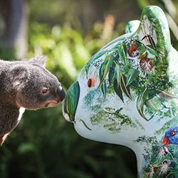
Things to do
Best Walks in Port Macquarie
Port Mac is genuinely one of the best walking regions on the NSW coast, and locals will tell you that for free!
Coastal walks with whale watching and dramatic cliff vistas, rainforest boardwalks, hinterland adventures and lookouts.
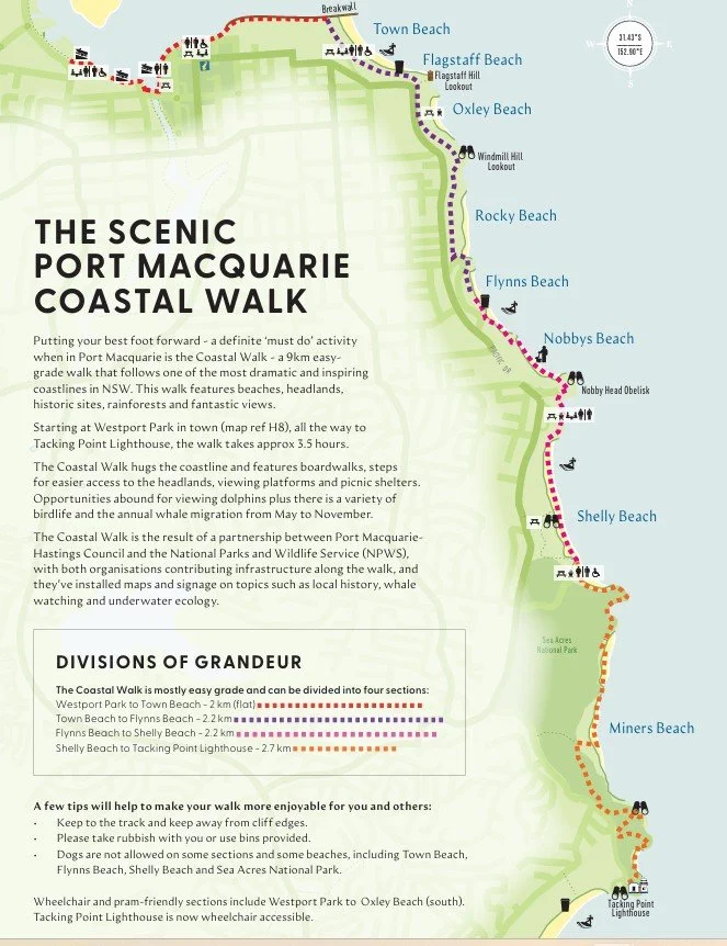
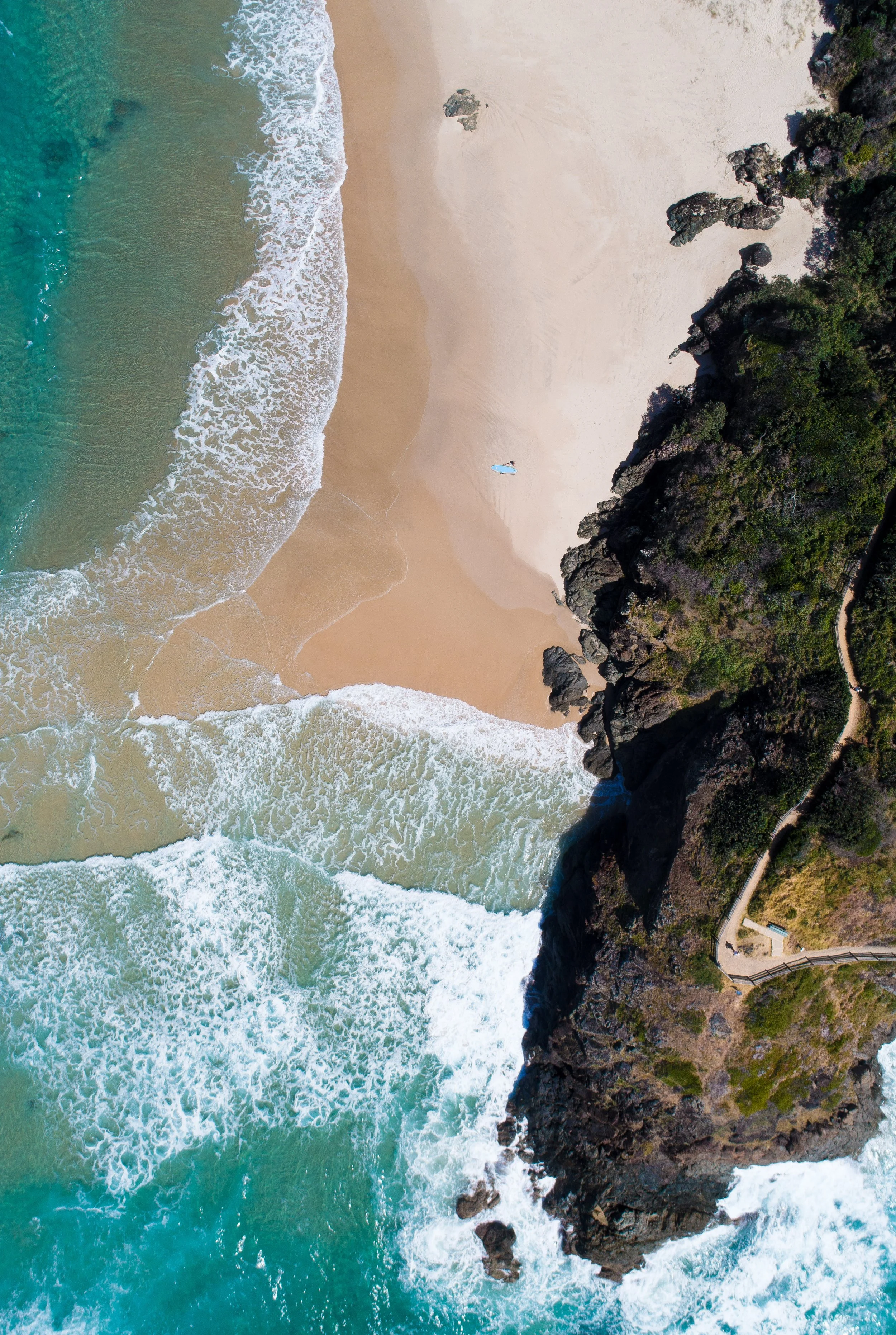
Port Macquarie’s Coastal Walk by Southon Exposures.
The Port Macquarie Coastal Walk
Arguably one of the most scenic walks in Australia, you can vary the difficulty and do it in small sections, or tackle the whole 9km at once!
Distance: 9 km (one way)
Difficulty: Varies from easy and accessible, to sections of steep stairs and beach. See more below.
Time: Approx. 3.5 hours
Start: Westport Park, Port Macquarie
Finish: Tacking Point Lighthouse
If you do one thing in Port Macquarie, make it this walk. Seriously. The Coastal Walk is nine kilometres of pure gold, hugging one of the most dramatic coastlines in New South Wales from Westport Park all the way south to Tacking Point Lighthouse.
You’ll pass beaches, headlands, rainforest pockets, historic sites, and views that will make you want to move here permanently. The walk is mostly easy grade so pretty much anyone can tackle it, and the signage along the way tells you all about local history, whale watching and underwater ecology so you’re learning stuff without even trying.
Dolphins pop up regularly (especially off the headlands), and if you’re visiting between May and November you’ve got a solid chance of spotting humpback whales on migration. It genuinely doesn’t get better than this.
You don’t have to do the whole thing in one hit either. The walk breaks up nicely into four sections:
• Westport Park to Town Beach: 2 km (flat, great for prams and wheelchairs)
• Town Beach to Flynns Beach: 2.2 km (stairs, hills)
• Flynns Beach to Shelly Beach: 2.2 km (stairs, beach, hills, trails)
• Shelly Beach to Tacking Point Lighthouse: 2.7 km (steep stairs, beach, hills, trails - reasonable level of fitness advisable)
The section from Westport Park to Oxley Beach is wheelchair and pram friendly, and Tacking Point Lighthouse is now wheelchair accessible too. Dogs are not permitted on some sections including Town Beach, Flynns Beach, Shelly Beach and Sea Acres National Park, so leave the pooch at home for this one.
LOCAL TIP
Start early and walk south so the light is behind you for photos. Stop for refreshments at one of the cafes (Westport Club at Westport Park has a coffee window, Little Shack at the start of the Break Wall, Salty Crew at Town Beach, Roam, Cocoa Cartel or Sandbox at Flynns Beach, Rainforest Cafe at Shelly, Coast at Lighthouse Beach). You’ve earned it!

North Brother Mountain Lookout- Dooragan NP
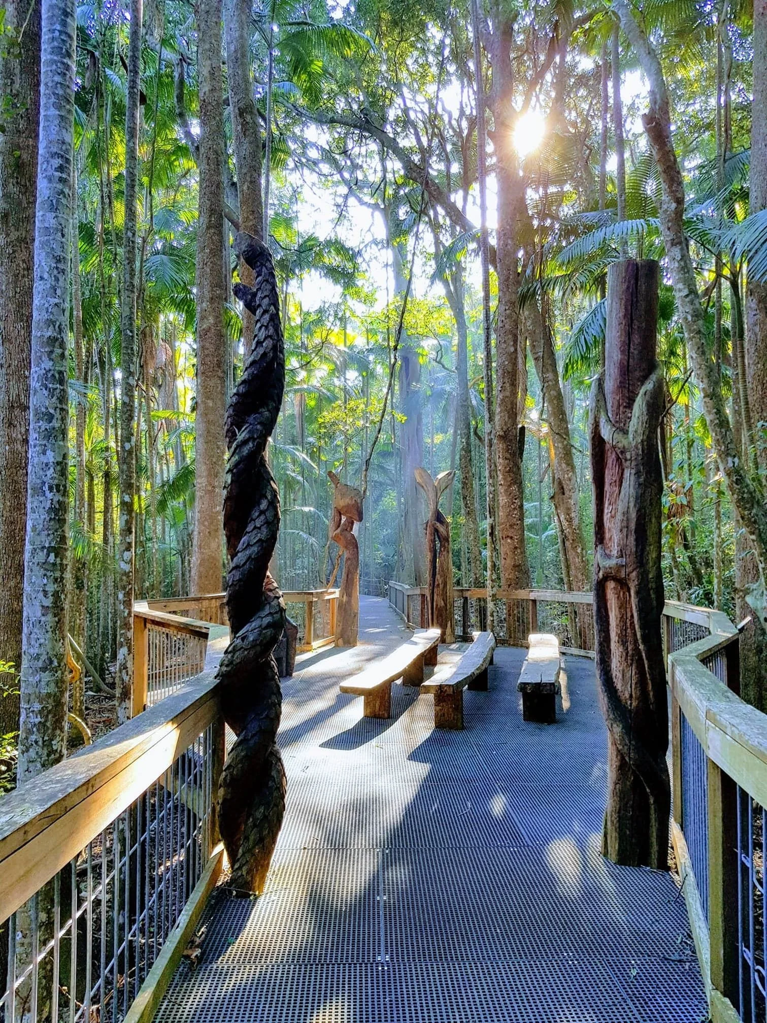
Sea Acres Rainforest Boardwalk

Beach to Beach Pathway- Dunbogan-byWitney Studios

Port Macquarie Coastal Walk
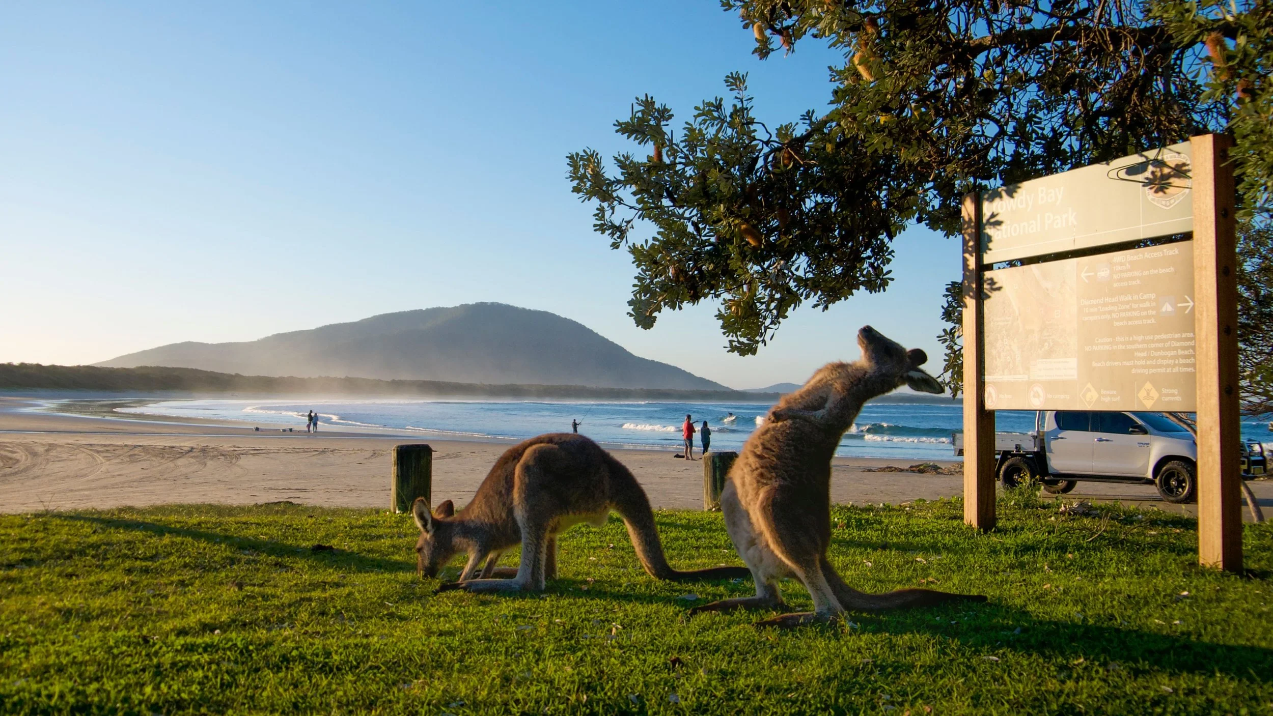
Diamond Head, Crowdy Bay NP, image credit Destination NSW
Distance: Approx. 5 km loop
Difficulty: Easy to moderate
Time: Approx. 2 hours
Location: Crowdy Bay National Park
Head to the southern tip of the region and you’ll find Crowdy Bay National Park, a bit of a secret weapon when it comes to beautiful walking.
The Diamond Head Loop is one of those walks that rewards you at every turn with pristine beaches, wildflowers, wetlands, unique rock formations,
and more wildlife than you can poke a stick at.
The campground at Diamond Head is brilliant (and very popular, so book ahead), and the surrounding day use areas give you plenty of options for extending your time out here. Kangaroos are basically permanent residents at the campground, so expect a few furry photobombers.
This part of the park has a real ‘edge of the world’ feel to it. The coastline is wild and raw, the rock formations are genuinely spectacular, and you’re unlikely to bump into crowds. If you’re into birdwatching, wildflowers or just want somewhere that feels properly off the beaten track, this is your spot.
LOCAL TIP
Pair this with a drive through the hinterland villages of Kew and Kendall on the way back. Stop for a next-level pub lunch at the landmark Royal Hotel, or a famous pie at the Kew General Store, or a legendary sweet treat at Miss Nellie’s Cafe.
Diamond Head Loop
Beach to Beach Pathway
Distance: Approx. 11 km (one way)
Difficulty: Easy
Time: 2-3 hours
Location: North Haven to Dunbogan
The Beach to Beach pathway from North Haven to Dunbogan is one of those easy, feel-good coastal walks that delivers far more than the effort you put in. It hugs the edge of the Camden Haven River, linking North Haven’s breakwall through Laurieton and across to Pilot Beach at Dunbogan in a mostly flat, accessible route. It’s the kind of walk you can chip away at in sections or tackle in one go, with a mix of shared path, boardwalks and the occasional quiet road section as the full route continues to evolve.
What makes this walk special is the ever-changing scenery. One minute you’re beside calm river water with dolphins occasionally cruising past, the next you’re weaving through mangroves and paperbarks on timber boardwalks, then popping out near cafés, parks and picnic spots. It’s relaxed, unhurried and very local in feel, with plenty of places to stop, grab a coffee or just sit and take it all in. Whether you’re walking, jogging or rolling along on a bike, it’s an easy, scenic way to experience the laidback rhythm of the Camden Haven.
LOCAL TIP
Bring swimmers and start or finish at the Beach Break Café on the North Haven beachfront! For a calmer spot, try the North Haven netted tidal pool in the river.
Perpendicular Point, Kattang Nature Reserve
Distance: Flower Bowl Circuit: 2 km | Perpendicular Point Walk: 3.6 km
Difficulty: Easy to moderate
Time: 45 minutes to 1.5 hours depending on route
Location: Kattang Nature Reserve, Dunbogan (via Dunbogan Bridge)
This one genuinely stops people in their tracks. Cross the Dunbogan Bridge and follow the signs into Kattang Nature Reserve, and you’ll end up standing at Perpendicular Point where the cliffs drop a sheer 40 metres straight into the ocean. It’s one of those views that makes you go a bit quiet.
You’ve got two options here. The Flower Bowl Circuit is 2 km and an absolute delight in spring when the wildflowers are going absolutely bananas. The longer Perpendicular Point Walk at 3.6 km takes you right out to the cliff edge for those epic coastal views and, during whale season, some of the best whale watching in the region from land.
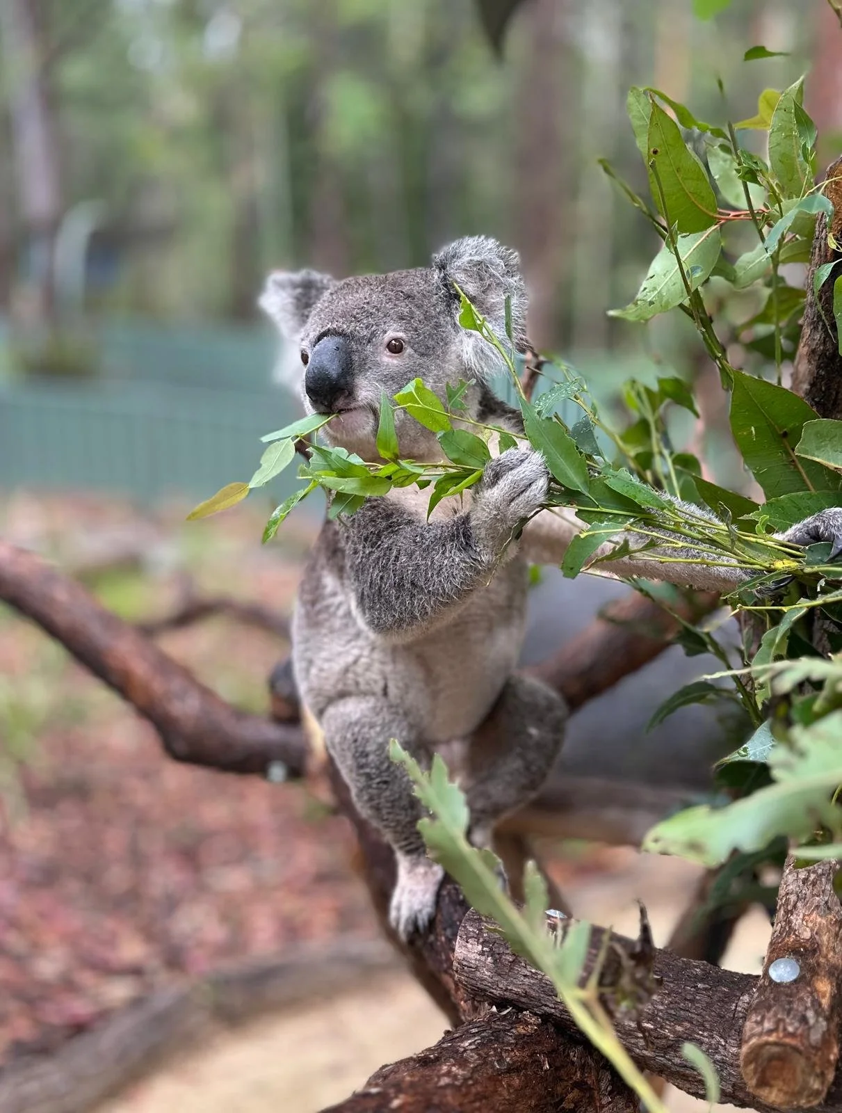
This is also a great spot for birdwatchers. The heath and coastal scrub here support a really lovely variety of birds, and you’ve got koala habitat in the area too so eyes peeled on the way in.
LOCAL TIP
While you’re in Dunbogan, pop into the iconic whitewashed Dunbogan Boatshed for a coffee and feed the fish off the wharf. The new over-water timber walkway nearby has fab views too.
Rawson Falls, Boorganna Nature Reserve
Distance: 2.7 km return
Difficulty: Moderate
Time: Approx. 1 to 1.5 hours
Location: Boorganna Nature Reserve, Comboyne Plateau
This one is a bit of a trek to get to but absolutely worth it. Head up to the Comboyne Plateau in the hinterland and you’ll find Boorganna Nature Reserve, 396 hectares of lush subtropical rainforest that feels like a completely different world from the coast.
The 2.7 km trail to Rawson Falls winds through towering rainforest, past ferns, mosses and ancient trees, to a beautiful waterfall tucked deep in a gorge. It’s cool, green, quiet, and genuinely magical. Birdwatchers, bring your binoculars because this trail is paradise. You might spot lyrebirds, satin bowerbirds, king parrots and more if you’re patient and keep the noise down.
The trail is moderate in difficulty, with some uneven ground and a descent into the valley, so decent footwear is a good idea. This one is a genuine hidden gem that even a lot of locals haven’t done, which makes it all the more satisfying.
LOCAL TIP
BYO swimmers and combine with a cool dip at the base of the falls. Combine your visit with a wander through the charming Comboyne village and a stop at the Comboyne Plateau lookout for views back across the Mid North Coast. The plateau is also fabulous dairy and farmland country so keep an eye out for farm gate produce on the way.
Queens Lake Nature Reserve
Distance: Various trails, 1 to 5+ km
Difficulty: Easy
Time: 30 minutes to 2+ hours
Location: Queens Lake, near Bonny Hills
Queens Lake is one of those places that locals love to take visiting friends and family because the reaction is always the same: ‘why haven’t I heard about this place?’ Just minutes from Bonny Hills, this peaceful nature reserve is a little slice of paradise tucked away from the main tourist trail.
The walking trails here wind through coastal heath, paperback wetlands and along the shores of the lake, and the whole vibe is serene and unhurried. It’s perfect for a leisurely wander, a family picnic, or a morning paddle. Speaking of which, kayaking on Queens Lake is absolutely brilliant and a lovely way to explore the waterway from a different angle.
Koalas are regularly spotted in the reserve, particularly in the eucalyptus trees around the lake edges, so this is a genuinely good bet if you’re keen to see one in the wild. Also great for fishing and birdwatching, with a lovely mix of water birds making this their home year round.
LOCAL TIP
Come early morning for the best chance of spotting koalas and water birds on the lake. Bring a picnic and your kayak or paddleboard if you have one, and plan to stay a while. This is not a place you want to rush.
North Brother Mountain, Dooragan National Park
Honestly, if you only do one thing in the Camden Haven, make it this. The views from the top of North Brother Mountain are absolutely jaw-dropping and, good news, you can actually drive to the summit lookout if the legs aren't up to it (no judgement here). You’ll find it in Laurieton, about 40 minutes south of Port Macquarie.
There are three ways to earn those views on foot. The Rainforest Loop (30 minutes, easy) winds through beautiful subtropical rainforest and is perfect for kids or anyone who just wants a taste of the bush without committing to a full workout. Step it up with the moderate summit trail (around 1 hour return) for a proper hike through towering trees and wildlife-rich bushland. Feeling keen? The Laurieton Track (2 hours) is the one for you. It's challenging, it's beautiful, and you'll feel very smug about it afterwards.
At the top, you're looking out over Queens Lake and the entire Camden Haven coastline. On a clear day it's one of the best coastal panoramas on the Mid-North Coast, full stop. Bring snacks. Take photos. Linger longer than you planned.
Good to know: The park entrance is via Mountain View Road off Ocean Drive. No entry fee. Sturdy footwear and water are a must. Go early to catch the light (and beat the selfie crowd).
After the walk: You've earned a coffee and something to eat in Laurieton, just five minutes down the road. Plenty of great options waiting for you there.
Locals Love